Premier Inn London Holborn map


Premier Inn London Holborn From Central London: 1.0 miles (1.7 km)
nearest
Tube Station: Holborn 0.3 miles (0.5 km)
Railway Station: Farringdon 0.5 miles (0.8 km)
Motorway: M1 Junction 1, 6 miles (9.7 km)

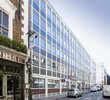
Address: 27-29 Red Lion Street, Holborn, London, WC1R 4PS

Hold down your left mouse button down while clicking on the map, keep it held down to move the map around. Use the + and - symbols on the maps left bar to zoom in and out.. Click an icon to view hotel information

>>>BACK TO PREMIER INN LONDON HOLBORN PAGE

SHOW NEXT NEAREST HOTELS:  1-10:  11-20:   21-30:   31-40:   41-50:    


Directions: Exit Holborn Tube Station towards "High Holborn and British Musuem". Cross the main road and turn right towards High Holborn Street. Turn left into Red Lion Street (second street) on your left. You will find the hotel on right hand side. No onsite parking is available. Closest car parks: Bernard Street WC1N 1LE and Bloomsbury Square Car Park on Bloomsbury Square WC1A 2RJ.

>>>BACK TO PREMIER INN LONDON HOLBORN PAGE

Privacy Policy
Copyright © 2021 Milesfaster.co.uk All Rights Reserved